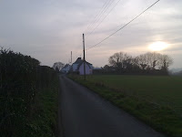
The village of Ripple is mentioned in the Domesday Book, and the church has Anglo Saxon foundations. Therefore the great age of the village is not under dispute, but it is quite striking to any one who cares to look, that the visual evidence of the antiquity of the village is largely missing.
Indeed, it is documented that the Romans passed by the village after their landing at nearby Walmer, and evidence of their earthworks can be found approximately a quarter off a mile north of the village church, on the ancient pathway towards present day Deal.
However, unlike the adjacent villages of Greater Mongeham , Northbourne and Ringwould, there are very few old buildings that have survived from periods earlier than seventeenth century.
The only surviving buildings that can attest to the ancient lineage of the village are from no earlier than the 1600 with the Plough public house, Ripple Farm, Ripple Vale House (now a school), the Rectory, Ripple Court, Cherry cottage and the Queen Anne style Ripple House being the only examples.
Indeed, the church,St Mary's, normally the oldest building in an English village is in fact Victorian, although supposedly built on Anglo Saxon or Norman foundations.

Ripple Mill was originally in use as early as 1695 but the present Mill was brought from Hawkinge in approx 1810 having been built in 1769.
In particular, its very strange to note the lack of any medieval buildings between the Plough public house and the church.
Presumably this would of originally been the center of the Village, but with the exception of the Church, which has been rebuilt, all be it on the foundations of a Anglo Saxon Church, and the small cottage at the end of 19th century Portland Terrace, there are no truly old buildings. I say this assuming that the Manor House is the style of a French Chateaux next to the Rectory is of Queen Anne or similar age !.

This is strange, because the surrounding villages of Mongeham, Northbourne and Ringwould all have medieval structures !.
Furthermore, there is no information of the history of the fields that are situated behind the church graveyard, in particular at the summit of the hill / mound which is reached by walking directly up the footpath leading away from the churchyard gate.
Aerial photographs appear to identify the outline of ancient Round Houses on this site, although I have been unable to locate any artifacts or evidence on the ground !


